
Pakistan’s population, which was about 33.1 million in the 1951 census, has increased to around 240 to 250 million today. In this situation, it is not realistic to expect the same large provinces to provide services at the doorstep of the citizens. In the last fifty years, other countries have revised their internal maps from time to time to improve administrative efficiency. India created Jharkhand, Chhattisgarh and Uttarakhand in 2000, created Telangana in 2014 and reorganized Jammu and Kashmir in 2019, after which there are twenty-eight states and eight union territories today. Indonesia expanded in 2022 with four new provinces of Papua and currently has thirty-eight provinces. Nigeria increased the number of states to thirty-six in stages between 1967 and 1996 to bring government closer to the people.
All these examples suggest that governments adjust their internal maps based on administrative efficiency, not to harden ethnic politics. Smaller states have clear advantages, such as reduced distances, which mean closer service and oversight, and lower per-person burdens; more peer-to-peer units allow for better comparison of performance in education, health, police, and revenue; and systems such as budgets, courts, records, and police operate more efficiently in smaller units.
Workable criteria for division
Several criteria must be considered for a logical division of states. First, equal population, so that the burden of services per citizen is balanced, for example, eight to twenty million per state. Second, travel time and accessibility, meaning that 80 percent of the population can reach the provincial capital within three to four hours. Third, distribution according to service load, i.e., the real burden of schools, hospitals, courts, and police should be taken into account. Fourth, fiscal and economic viability, with local revenues and guaranteed transfers at least equal to or exceeding the service cost and at least one development corridor in each province. In addition, it is necessary to take into account waterways and river basins so that irrigation, flood control and water governance are based on a basin logic.
Geography and land structure, i.e., mountains, deserts and coasts, determine cost and accessibility. Road, rail, grid and fiber corridors form the real economic geography. Large cities and their transport circles should be considered as an economic unit. Command areas, pastures and land sizes are important in land use and agricultural systems. Emergency management should be viable in the face of floods, droughts, earthquakes, and border hazards.
Comprehensiveness or compactness is also necessary because long, thin shapes increase administrative costs. Administrative boundaries, i.e., districts and tehsils, should be kept as much as possible. Every province should have strong digital connectivity and access to data centers. Ports, borders, and gateways should be given resources and mandates according to logistical means. Finally, non-ethnic historical boundaries should be preferred, provided that they do not conflict with overarching principles.
These criteria can be weighted in three practical combinations. In an area-centric hybrid, area is given 40 percent weight, travel time is given 25 percent, population is given 20 percent weight, and financial viability is given 15 percent weight. In a service-first hybrid, service load is given 35 percent weight, population is given 25 percent weight, travel time is given 25 percent weight, and financial viability is given 15 percent weight. In an environmental resilience hybrid, hydrology is given 30 percent weight, hazard is given 20 percent weight, area is given 20 percent weight, infrastructure is given 15 percent weight, and tightness is given 10 percent weight.
A few safeguards are essential with each model: the province should be a single contiguous piece, and there should be no enclaves; names should be non-ethnic and geographical; Minimum service standards of teachers, doctors, courts and police per 100,000 population should be ensured through equalization; and maps, thresholds and scores should be published transparently.
Area-based proposal
The strong recommendation is that the basis of provinces should be area, i.e., about forty-five thousand square kilometers per province. If area is made the basic rule, Pakistan, which has a total area of about eight hundred eighty-one thousand nine hundred and thirteen square kilometers including Azad Kashmir and Gilgit-Baltistan, can be divided into about twenty provinces, and each province would be about forty-five thousand square kilometers with a ten percent increase or decrease with respect to natural boundaries and districts.
There are several arguments in favor of this proposal. First, it is non-ethnic and strengthens national unity, because area is not an identity and the politics of labeling Punjabi, Pashtun, Saraiki or Baloch fades away. Second, there is equity in land governance because irrigation, forestry, minerals and disasters are all area-intensive, and equal area creates equal responsibilities. Third, there is equity in infrastructure because roads, rails, grids, canals and fiber are measured in kilometers, so investment envelopes are balanced. Fourth, administrative constraints are achieved, and a 10% flexibility reduces travel times, improves monitoring and reduces costs. Fifth, demarcation remains apolitical and neutral geographical names can be adopted, such as North Indus or West Makran. An important implementation note with this is that minimum service standards should be implemented through NFC and equitable funding to ensure the protection of densely populated areas; i.e., the basis is area, but the service should be provided according to population.
Practical approach to allocation
The allocation process should be objective and non-ethnic. First, about 45,000 sq km Tiles of equal area should be created, districts should be preserved, and adjustments should be made along rivers, creeks, and the coast up to ten percent. Then, through travel time isochrones, it should be checked whether the majority of the population can reach the provincial center in the given time. Then, the viability of each proposed unit should be checked; that is, its economic base should be diversified, and at least one corridor or logistics node should be present within it. Finally, continuity should be maintained, enclaves should be prohibited, and non-ethnic names should be adopted.
Future Action Plan
To move this proposal forward, a clear division of labor is necessary as to who presents, who discusses, and who decides. The responsibility for the presentation lies with the Planning Commission, which should prepare a white paper containing two to three map options, including an equal area base and alternative proposals, as well as financial simulations, service floors, and an interim plan. Along with this, an independent commission should be established that includes lawyers, geographers and statisticians, and service experts, and which will work with clear criteria and metrics. The discussion stage should be at the Council of Common Interests and the public level, which will include inter-provincial consultations, district hearings, and sharing of standards and GIS data.
The decision should be through Parliament and provincial assemblies, which will require a constitutional amendment, and where there is a change in the boundaries of a province, the support of a two-thirds majority of the relevant provincial assembly under clause 4 of article 249 will also be required. After this, reorganization acts should be passed which will list the details of assets, cadre, courts and responsibilities, as done in the Indian model. The interim arrangement should last for eighteen to twenty-four months, in which transition authorities should be established for each new province to look after HR postings, budget, records, police, courts and revenue matters, and the service floors should be locked in the interim award of the NFC.

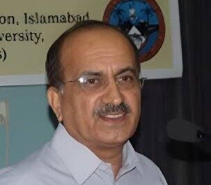
Dr. Syed Tahir Hijazi is a senior economist and the Vice Chancellor of Muslim Youth University, Islamabad. A veteran academician with experience teaching in the USA, Greece, and the UAE, he is a leading expert on Islamic banking and governance reform. He has held top executive roles at the University of Central Punjab (UCP) and the International Islamic University (IIUI) and continues to advise the Government of Pakistan on civil service modernization and economic planning.